
XPLANNER
Practical and intuitive: for planning in the field or in the office
XPlanner is Xmobots' exclusive mission planning software for drones. The platform consists of a geographic information system (GIS) in which the user specifies the type of mission, the aircraft model, the camera used, the type of operation and the area of interest. Based on this information, XPlanner makes the necessary calculations and creates the drone's flight plans for carrying out the missions. One of its great differentials is the "multipolygon" function, in which, in the same flight plan, the pilot can fly over different areas in a practical and intelligent way.
Intelligent flight
One of its great differentials is the "multipolygon" function, in which, in the same flight plan, the pilot can fly over different areas in a practical and intelligent way.
Agility in missions
With a friendly and intuitive interface, as well as pre-configured options for most applications, the software has been developed so that the user can create missions in the field or in the office, with the speed and agility that is increasingly required in day-to-day work.
Quick and safe missions in just 5 steps:
01.
Only XPlanner has product-oriented planning.
Anyone who has been involved in the world of drones knows how important it is to plan a flight with the right parameters. Errors in the GSD (Ground Sample Distance), the overlap and the sensor can completely invalidate a job, causing major damage to the operation. The more experienced the pilot, the lower the chances of these mistakes happening. But what about those new to the technology?
To help this ever-growing audience, XPlanner's first step in the "Assistant" menu is "Mission Type", a feature that provides pre-defined flight patterns for different applications. In this way, the user has the option of manually entering these parameters (choosing GSD and overlap) or opting for the flight settings predetermined in the software. A simple and practical way to always get the best product.
Applications with predefined flight parameters in XPlanner:
Agriculture
Sugarcane - line and fault
Agriculture
Soybeans - Nutritional deficiency
Forestry
Counting trees
Livestock
Cattle - Counting individuals
Topography
Planialtimetric survey

02.
Which drone do you operate?
Each Xmobots drone has its own specifications for autonomy, range and payload. That's why, when planning the flight, XPlanner asks the pilot to indicate which aircraft and version they are using in the operation, so that the mission can be optimized according to the drone's characteristics.
03.
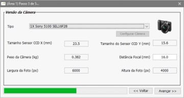
Choose your camera
Are you flying RGB or multispectral? As these are different mission parameters, choosing the right camera allows XPlanner to make the correct calculations for each type of sensor. This way, the pilot gets it right every time, generating quality products that can meet customer expectations.
04.
Will you be flying VLOS, EVLOS or BVLOS?
Xmobots is the only company in Brazil with drones authorized by ANAC to fly above 400ft. Using the airspace requires responsibility and seriousness, always respecting ANAC and DECEA regulations. That's why Step 4 of the Wizard menu is precisely the choice of the Type of Operation that will be carried out:
VLOS (Visual Line of Sight)
EVLOS (Extended Visual Line of Sight)
BVLOS (Beyond Visual Line of Sight)
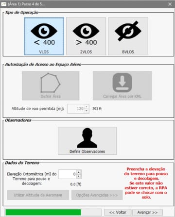
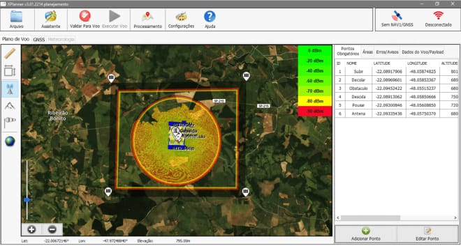
Depending on the type of operation chosen, XPlanner creates an outer visual buffer zone in yellow, red and black, from the inside out:
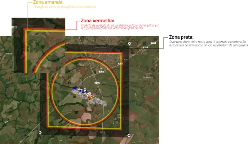
Yellow zone
Activation of the electronic fence violation alert.
Red zone
The electronic fence violation alert causes the drone to automatically recover and return to land.
Black zone
When the drone enters this zone, automatic flight termination recovery is triggered via parachute deployment.
05.
Definition of the mapped area and mapping parameters
Here the operator can draw the mapping polygon or upload a ".KML" file, as well as define the angle (cardinal direction of the lines), buffer, flight height and line interleaving (if desired).
The pilot can also configure the Terrain Data options, choosing "Track Elevation" (constant height above the ground), "Average Elevation" (the system sets an average reference elevation for the terrain) and "Manual Elevation".
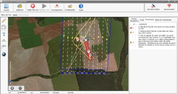
Once the mapping area has been entered, XPlanner automatically creates some mandatory waypoints. These are: Climb, Take-off, Obstacle, Descent and Land.
Intelligent validation
Once the project/flight plan has been created, XPlanner has an intelligent function for validating the mission before loading it onto the drone. If there are errors in the flight plan, the user can repair them before proceeding with the flight. This is reliability and safety, trademarks of Xmobots.
XPLANNER
See also


XSIS 222A – Aeronave Tripuladas
- O XSIS 222A é um sensor EO/IR nacional desenvolvido para ampliar a consciência situacional de helicópteros em operações de segurança pública, patrulhamento...
AMS7G
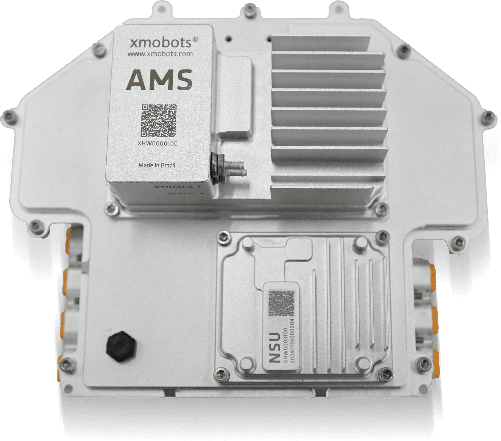
- 7th Generation Avionics System from the FW7 Platform Core technology of the Nauru 100D for more stable, safer, and smarter flights...

XPR
- Advanced reports for accurate decisions. Xmobots' XPR is software that concentrates and connects all data generated by the aircraft with the information defined in the mission, offering a complete and integrated view of the operation's results....
Portable GCS
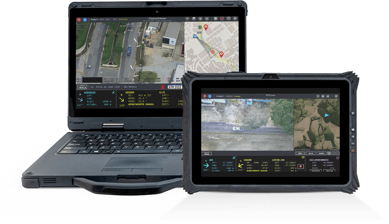
- The Ground Control Station (GCS) is the operational center of Xmobots ARPs, concentrating essential command and control functions. Through it, the pilot controls the aircraft, monitors telemetry in real time, and manages the different payloads on board.
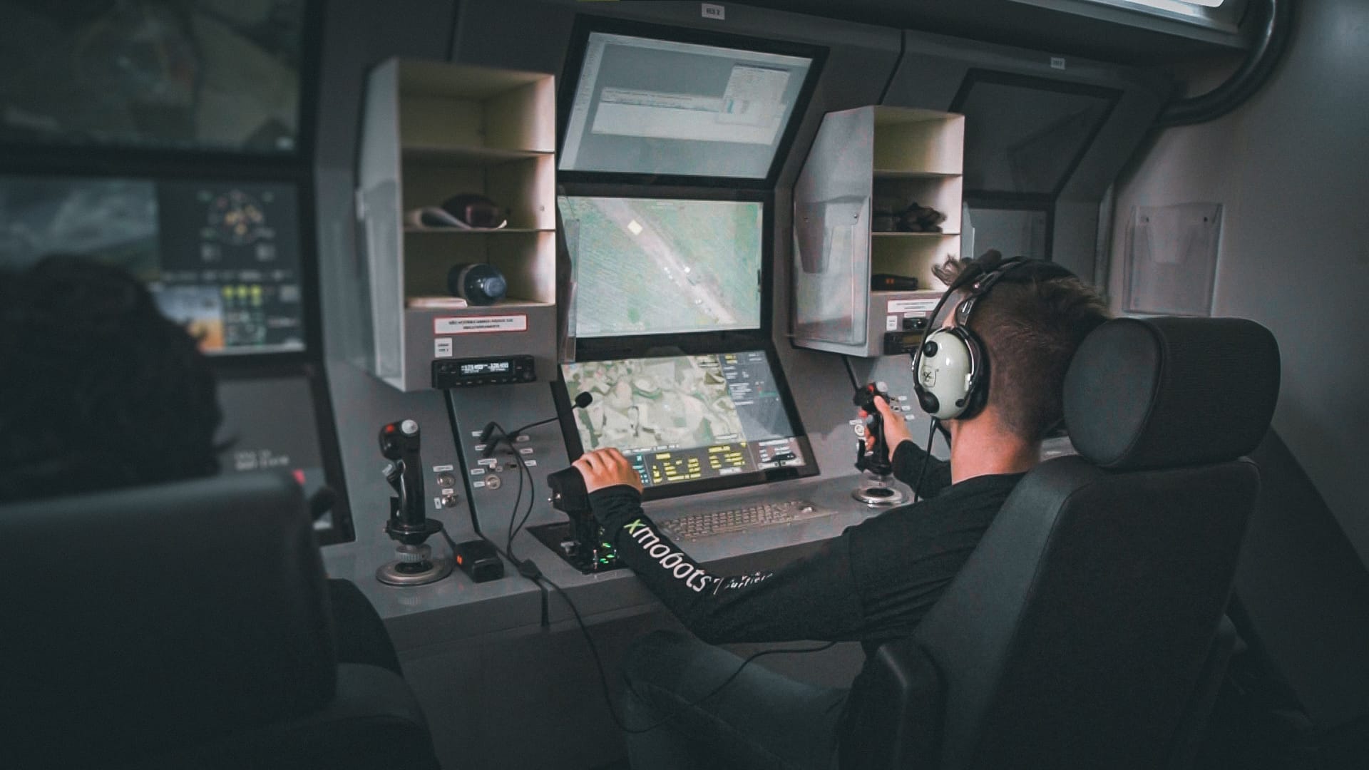
GCS319A
- The GCS (Ground Control Station) is the control station integrated into the Shelter system that connects the operator to the drones and their payloads, such as gimbals and radar, offering safe, efficient, and ergonomic operation, ideal for long-duration missions....
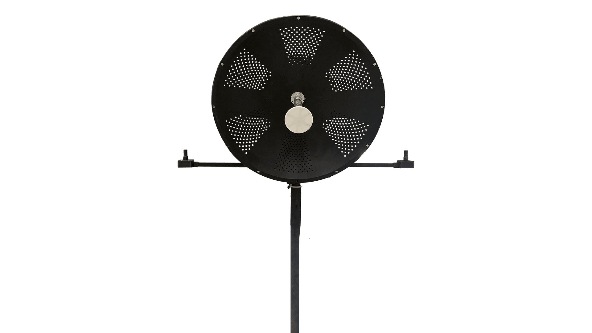
GDT
- The GDT is the terminal responsible for creating the point-to-point communication link between the ARP and the GCS. It ensures the secure and continuous exchange of commands, telemetry, and payload data throughout the mission...

XCOCKPIT
- XCOCKPIT is complete software for operating and monitoring drones, offering real-time control and detailed data analysis for efficient and safe mission management.

SIS 031A
- Maximize your power to act with the SIS031A sensor, the technology that transforms vision into strategy and intelligence. With advanced multi-target tracking, real-time distance calculation, and accurate identification, you have complete control...