XSIS
The right choice for intelligence, security, surveillance and rescue missions
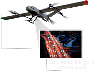
XSIS Manager is a sensor and data management system for intelligence, surveillance and reconnaissance missions, including VMS (Video Management System), facial and license plate recognition solutions.
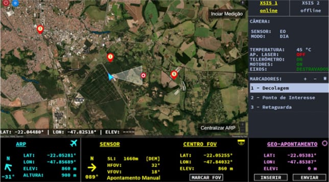
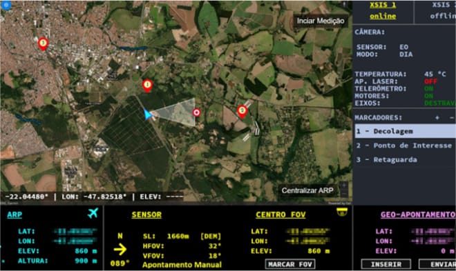
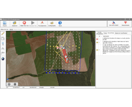
In XSIS Manager's mobile map interface, the operator controls the sensor by identifying the region being monitored. It is possible to view the RPA's coordinates and the ground in the area where the sensor is located, as well as pointing the sensor at a specific coordinate.
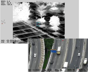
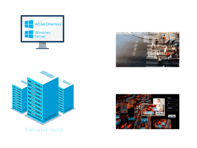
In XSIS Manager's video interface, the operator receives images in the visible and thermal spectra, allowing them to start recording, record photos, track moving targets, track fixed targets, and the AI automatically recognizes boats, cars and people, marking them and making it easier to track them.
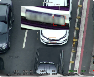

When a car is being tracked, you can take photos and start the license plate recognition system. On the other hand, when people are being tracked, you can take photos and start the facial recognition system.

Facial Biometrics
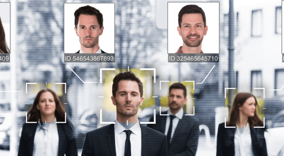
XFB is facial biometrics software that allows users to identify individuals and their characteristics using computer vision and artificial intelligence, creating a database of up to 500,000 individuals containing comments and characteristics about each one.
Personalized database search
Manual and automatic registration of new individuals to the database
Identification of individual characteristics
Fast processing
Compatible with Android and IOS systems
Video formats: H.265 and H.264
Easy and personalized search
The software allows the user to carry out personalized searches in its database in three ways:
Feature filters
The operator can search for an individual in their database using information such as name, gender, age, height, width, facial features (use of beard, moustache, glasses, mask), among others.
Similarity
The software makes a comparison with a new photo, whether it is a photo file or a detection during image capture. The percentage of similarity found is provided.
Route search
The system allows the user to search for individuals who have passed along a certain route defined on a map.
Face detection and identification of individuals
During a capture operation, several faces can be detected in a single frame. At least 30 faces are identified per second, with the system operating at 20 fps (frames per second), providing the operator with information on each individual identified, according to the database. If the individual is not registered in the database, the operator can enter it using the characteristics identified by the software's intelligence or manually.
For more effective use, the operator can also record the data for later consultation in video format, as well as generate personalized alerts.

Complete external database
With a large capacity for storing records, the user can retain information on more than 500,000 individuals, including photos, name, gender, height and visual characteristics, as well as being able to include comments about people.
Issuing a report
The software produces reports with personalized alerts, which trigger the sending of emails with the individual's information and capture instant photos.
To monitor operations, an app developed for Android and iOS automatically receives alerts, reports and the system's identification history.

License plate detection
XLPR is software for the automatic detection and identification of license plates and vehicle models using artificial intelligence and computer vision, allowing up to 500,000 vehicles to be registered in a database.

XSIS
See also
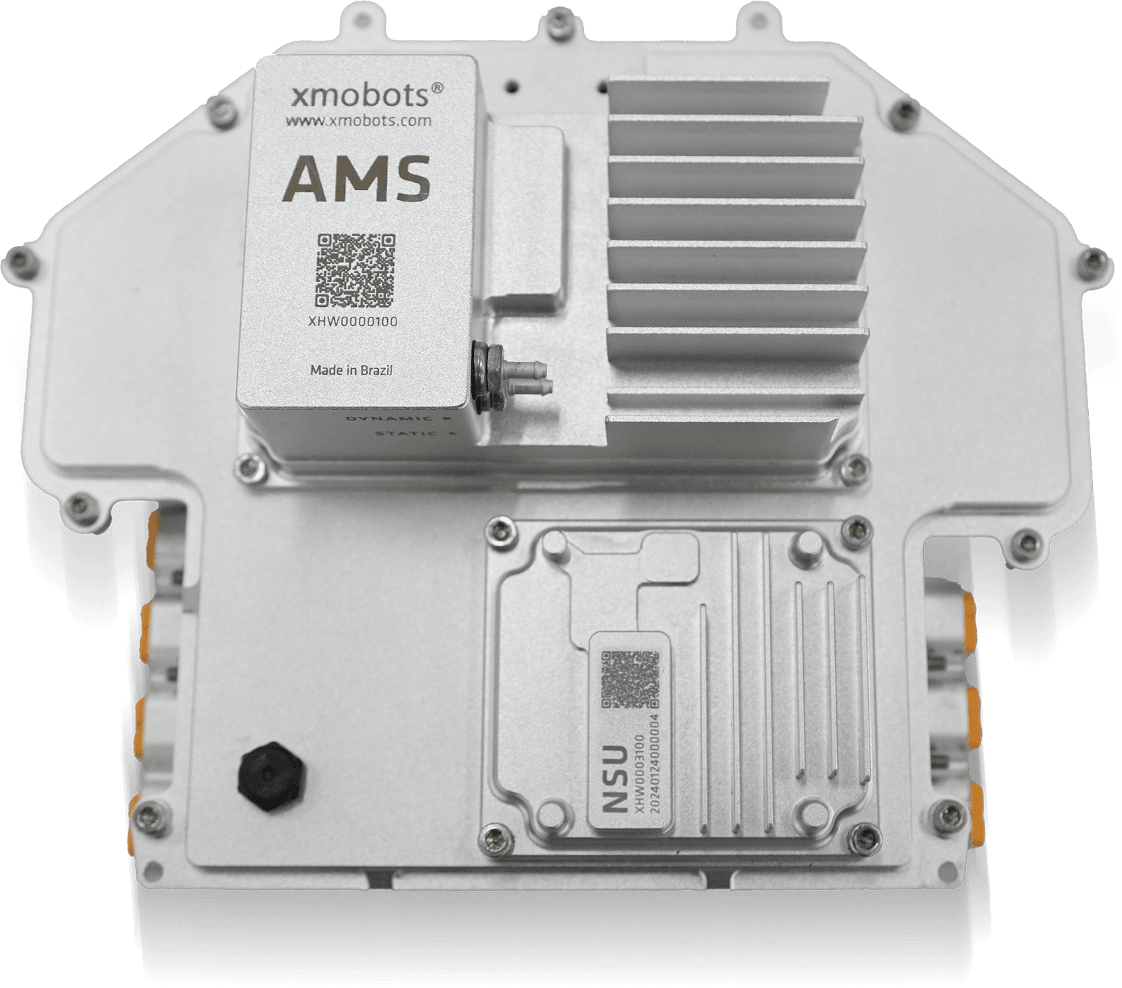
AMS7G
- 7th Generation Avionics System from the FW7 Platform Core technology of the Nauru 100D for more stable, safer, and smarter flights...

XPR
- Advanced reports for accurate decisions. Xmobots' XPR is software that concentrates and connects all data generated by the aircraft with the information defined in the mission, offering a complete and integrated view of the operation's results....
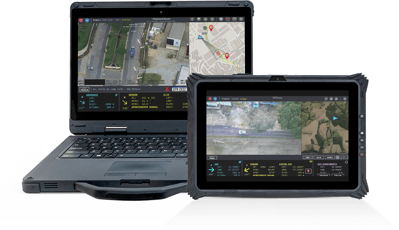
Portable GCS
- The Ground Control Station (GCS) is the operational center of Xmobots ARPs, concentrating essential command and control functions. Through it, the pilot controls the aircraft, monitors telemetry in real time, and manages the different payloads on board.
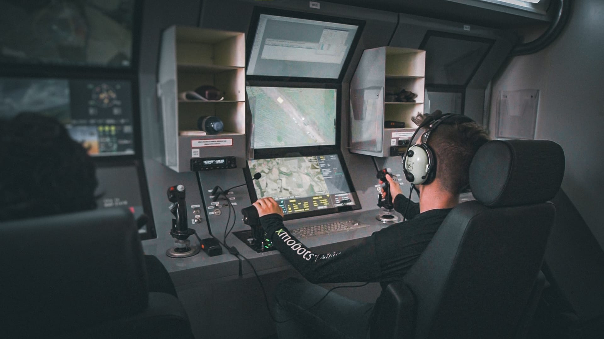
GCS319A
- The GCS (Ground Control Station) is the control station integrated into the Shelter system that connects the operator to the drones and their payloads, such as gimbals and radar, offering safe, efficient, and ergonomic operation, ideal for long-duration missions....
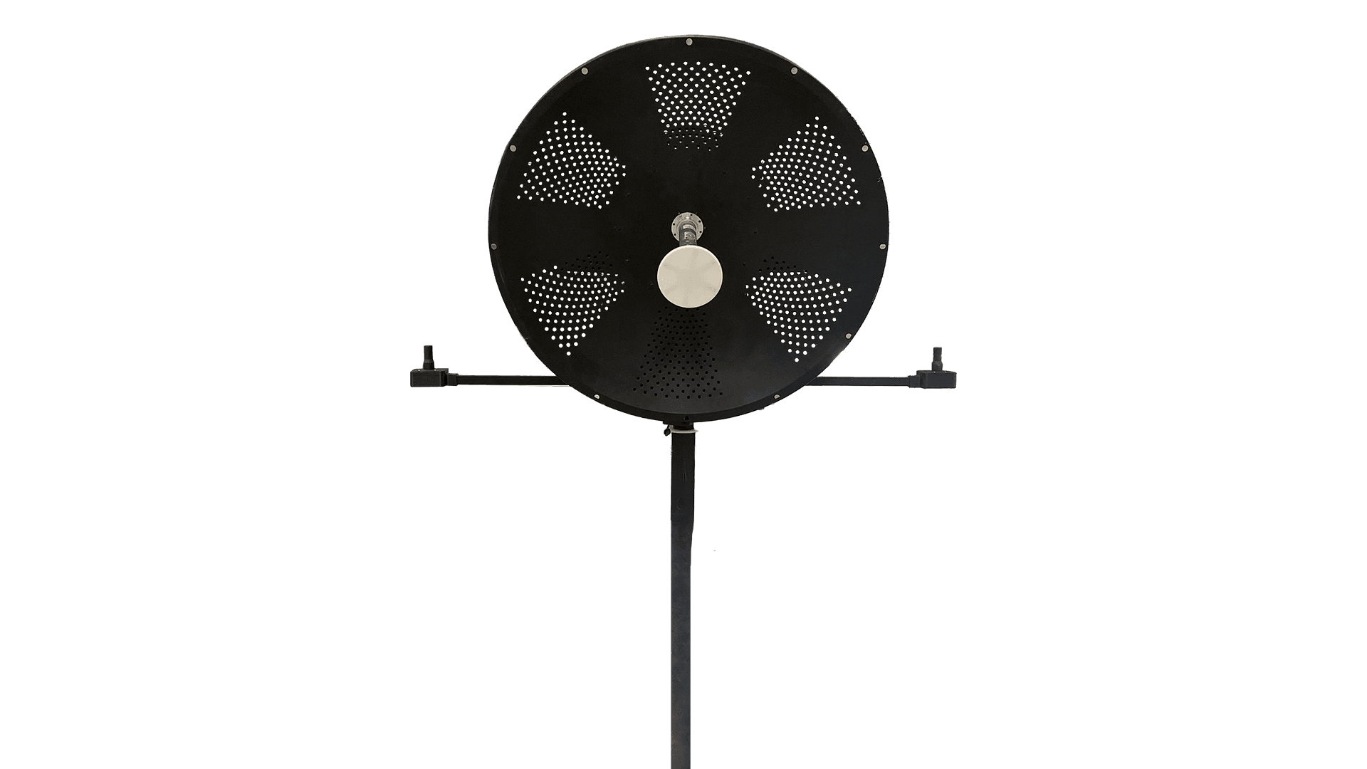
GDT
- The GDT is the terminal responsible for creating the point-to-point communication link between the ARP and the GCS. It ensures the secure and continuous exchange of commands, telemetry, and payload data throughout the mission...

XCOCKPIT
- XCOCKPIT is complete software for operating and monitoring drones, offering real-time control and detailed data analysis for efficient and safe mission management.

SIS 031A
- Maximize your power to act with the SIS031A sensor, the technology that transforms vision into strategy and intelligence. With advanced multi-target tracking, real-time distance calculation, and accurate identification, you have complete control...
XPLANNER
- XPLANNER is an air mission planning tool, guaranteeing efficiency, precision and optimization of resources, ideal for those seeking to maximize the results of air operations.