SIS132B

SIS132B Stabilizer Camera
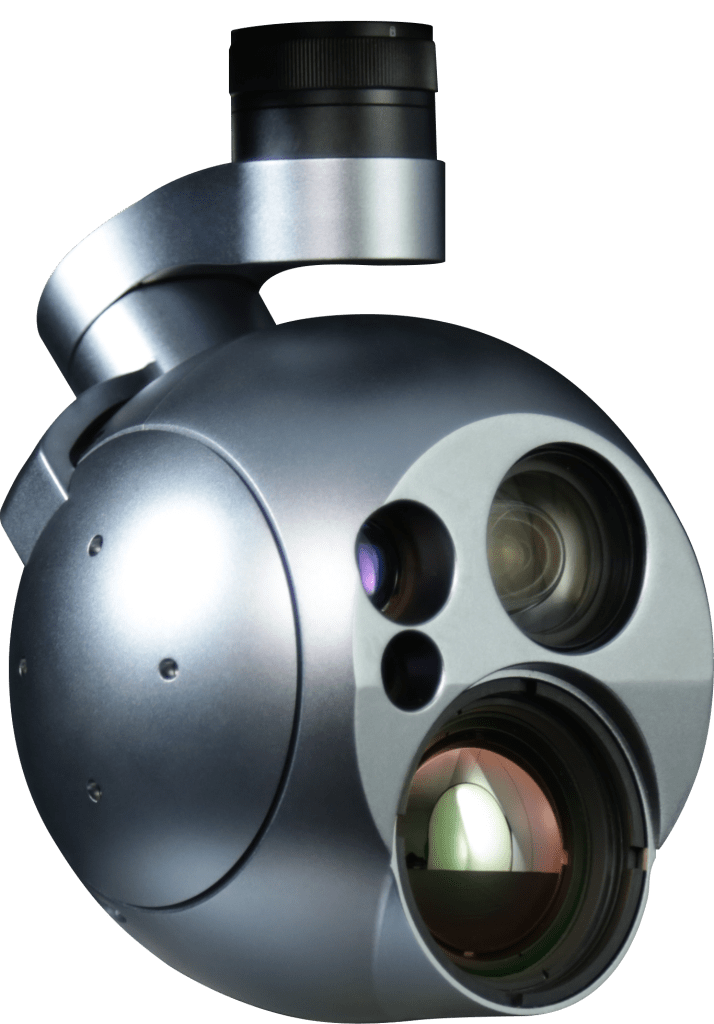
O payload giroestabilizado SIS132B possui sensor eletro óptico (visível) FHD com 30X de zoom ótico (360x combinado com zoom digital), e sensor infravermelho termal (LWIR) SD com lente de 50 mm. O equipamento possui capacidade de transmissão de vídeo com baixa latência (<300 ms) simultânea de ambas as câmeras em h.264.Possui sensor laser range finder para aquisição da coordenada geográfica dos alvos em solo, funções ICR para operações noturnas, função de rastreamento automático de alvos e apontamento georreferenciado. Os sensores são instalados em uma torreta giroestabilizada (gimbal) de 3 eixos, com estabilização em rool, pitch, yaw, e controle de elevação e azimute (360 graus contínuos). O equipamento é adequado para missões ISTAR diurnas e noturnas.


Real-time detection, recognition and identification of targets such as fire outbreaks or intruders
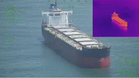
SIS 132B (EO + LWIR) for day and night missions
Daytime detection
Night detection
Humans detected at 16 km, recognized at 4 km and identified at 2 km
Humans detected at 1.5 km, recognized at 0.4 km and identified at 0.2 km.
Vehicles detected at 30 km, recognized at 10 km and identified at 5 km.
Vehicles detected at 3 km, recognized at 0.9 km and identified at 0.5 km.
Sensors:
Coordinates of targets (people, cars and photos)
30x optical zoom in RGB (360x when combined with digital zoom)
Thermal for low heat
Ability to recognize individuals, vehicles and vessels, day or night, on land or in the water.
This technology enables quick and efficient decision-making, thus minimizing losses caused by damage and incidents such as break-ins, theft, robbery and fire:
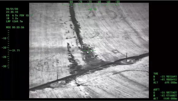
- Automatic tracking;
- Simultaneous monitoring of multiple targets;
- Detection and indication of moving targets (MTI);
- Support for elite operations, including target acquisition (geolocation), observation and adjustment of shots;
- Aim at coordinates defined by the operator.

Detection of fire outbreaks within 30km
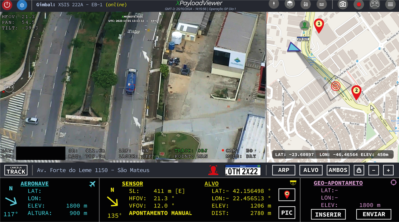
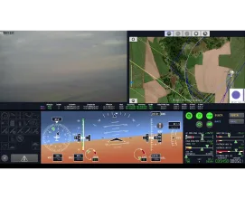
Surveillance interface with camera, map and target coordinates
Specifications
Stabilization
3 non-orthogonal axes, direct drive, brushless
Encoder Resolution:
0.09° Absolute
Weight:
1.6 kg
Physical Dimensions:
5.7 x 5.4 x 8.9 inches
Operating Temperature:
-20°C to +50°C
Mechanical Rotation Limits:
Pan: 360° continuous Tilt: -120° to +45°
Rotation Speed:
Up to 120°/s
Power Consumption:
typical 10.6W, max 20W
Voltage:
14.8V to 25.2V
Output interface:
Circular push-lock connector
Video Interface:
Digital (Ethernet)
Control:
Ethernet
LWIR Sensor
Sensor Type: Uncooled LWIR VOx
Spectral range: 8 - 14 μm
HFOV: 8.8°
Resolution and FPS: 640 x 512 @ 30 FPS
Zoom: 8x Digital
NETD: ≤40 mK@25°C
Lens type: 50 mm
EO sensor
HFOV: 64.0° - 2.4°
Resolution and FPS: 1920x1080 @ 30 fps
Zoom: 30x optical / 360x digital comb.
Sensor type: 1/2.8” STARVIS2 CMOS type
LRF Sensor
Range: 2.5 km NATO standard, 5 km max
Accuracy: ≤ ±1 m (RMS)
Wavelength: 1535 nm
Divergence Angle: ≤ 0.5 mrad
IR Pointer: Not applicable
Video specifications and functions
Latência de vídeo: <300 ms
Video support: H.264, H.265
Local storage: Removable microSD card (up to 256GB, Class 10, FAT32) and optional hardware-encrypted microSD card.
SIS132B

See also
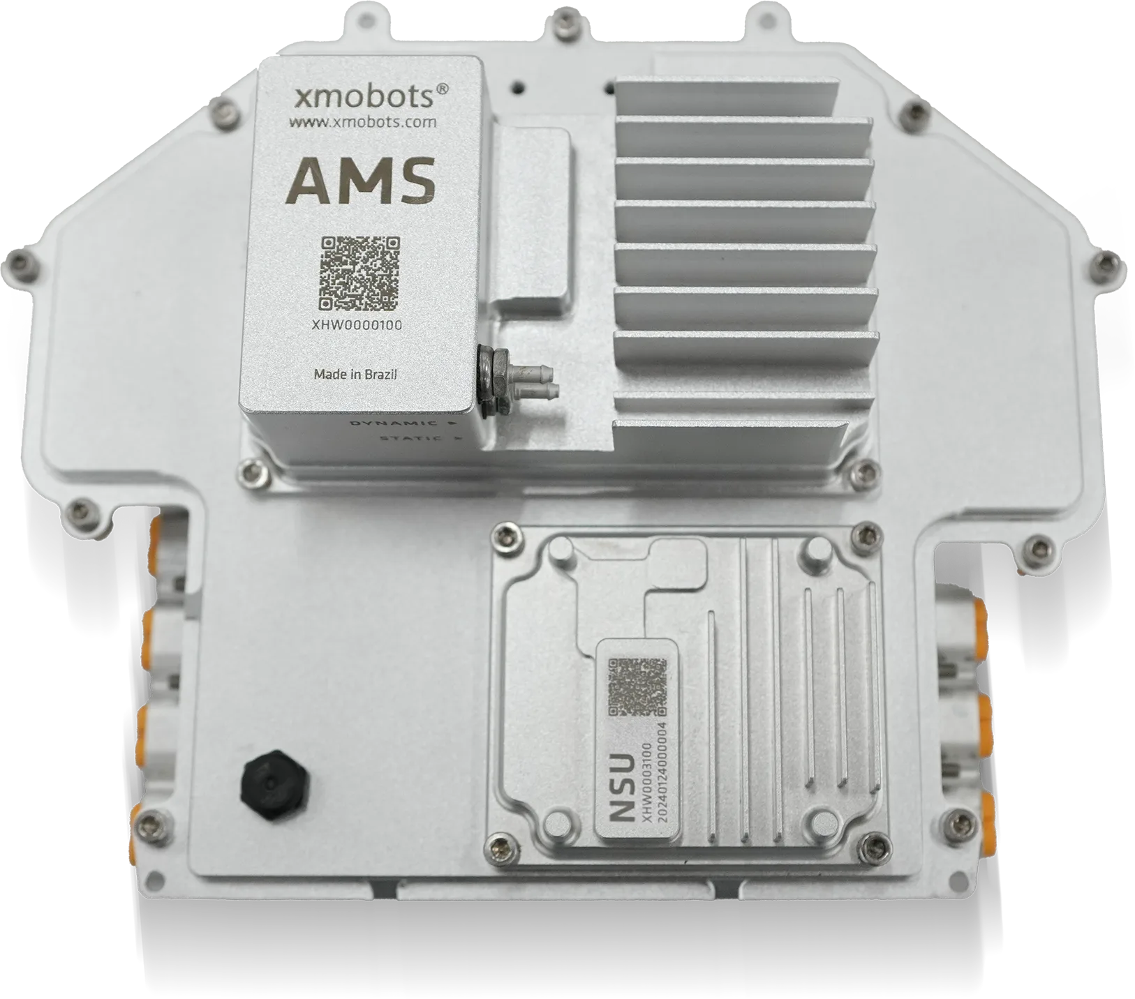
AMS7G
- 7th Generation Avionics System from the FW7 Platform Core technology of the Nauru 100D for more stable, safer, and smarter flights...

XPR
- Advanced reports for accurate decisions. Xmobots' XPR is software that concentrates and connects all data generated by the aircraft with the information defined in the mission, offering a complete and integrated view of the operation's results....

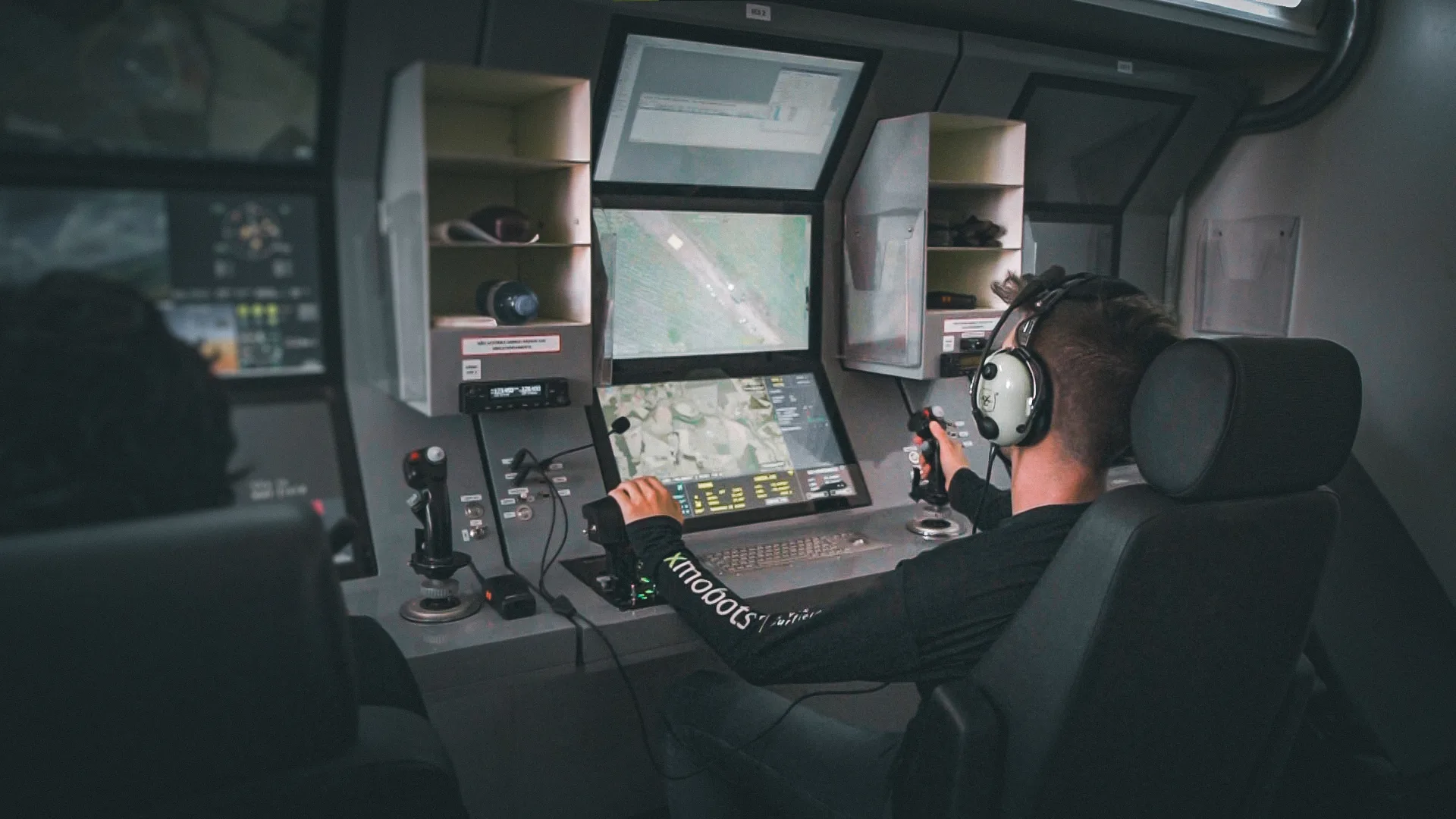
Portable GCS
- The Ground Control Station (GCS) is the operational center of Xmobots ARPs, concentrating essential command and control functions. Through it, the pilot controls the aircraft, monitors telemetry in real time, and manages the different payloads on board.
GCS319A
- The GCS (Ground Control Station) is the control station integrated into the Shelter system that connects the operator to the drones and their payloads, such as gimbals and radar, offering safe, efficient, and ergonomic operation, ideal for long-duration missions....

GDT
- The GDT is the terminal responsible for creating the point-to-point communication link between the ARP and the GCS. It ensures the secure and continuous exchange of commands, telemetry, and payload data throughout the mission...
XCOCKPIT
- XCOCKPIT is complete software for operating and monitoring drones, offering real-time control and detailed data analysis for efficient and safe mission management.

SIS 031A
- Maximize your power to act with the SIS031A sensor, the technology that transforms vision into strategy and intelligence. With advanced multi-target tracking, real-time distance calculation, and accurate identification, you have complete control...

XPLANNER
- XPLANNER is an air mission planning tool, guaranteeing efficiency, precision and optimization of resources, ideal for those seeking to maximize the results of air operations.