Practicality and high technology for small and medium-sized areas
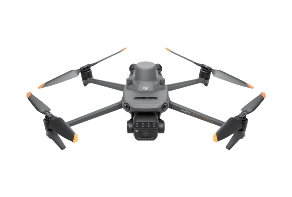
One of the most innovative multirotor drones on the global market, the Mavic 3 Multispectral is the perfect equipment for those looking for practical flight and versatility to fulfill different missions. Equipped with RGB and multispectral cameras, the M3M is a highly reliable and high-performance data capture tool for different scenarios.

Get cutting-edge technology to transform data into results
- 20MP RGB camera with 4/3 CMOS sensor
- Mechanical shutter 1/2000 s
- 5MP multispectral cameras (G/R/RE/NIR).
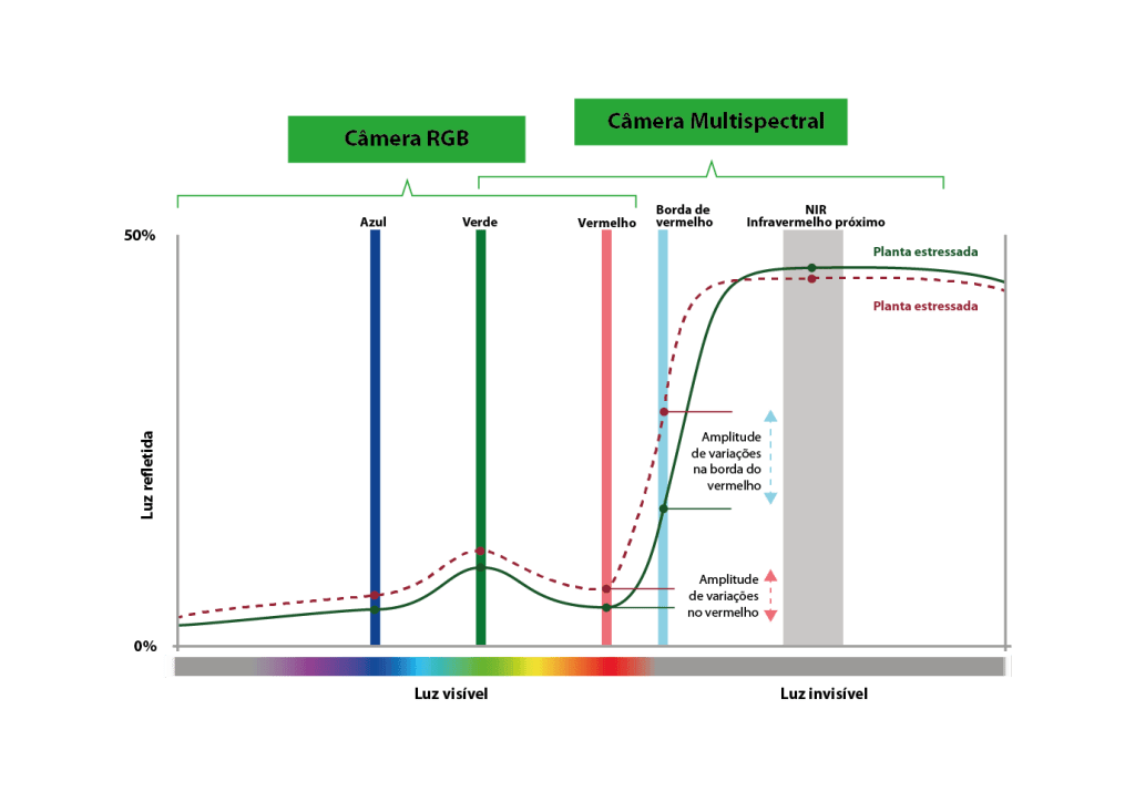
Multispectral camera
Near Infrared (NIR)
860 nm ± 26 nm
Red (R)
650 nm ± 16 nm
Green (G)
560 nm ± 16 nm
Red Edge (RE)
730 nm ± 16 nm
RGB camera
The Mavic 3M has an integrated ambient light sensor. During the flight, the
intensity of sunlight changes (for example: due to clouds or time of day).
The light sensor measures these variations in real time and the measurements are
used in the processing of multispectral images to calibrate vegetative
indices such as NDVI, NDRE, etc.

RTK module
Precision with XRTK
With XRTK, from Xmobots, connected to the to the Mavic 3 Multispectral, you get maps with centimeter accuracy
Without XRTK
Control Point
FLIGHT 2 - Ortho Corrected and Ortho Uncorrected Distance
PC02
1,338 m
PC03
1,334 m
PC05
1,340 m
PC10
1,339 m
PC12
1,335 m
With XRTK
Control Point
VOO - RGB - Payload 2.3.1
PC02
2.458 cm
PC03
1.717 cm
PC05
10.909 cm
PC10
4.096 cm
PC12
6.791 cm


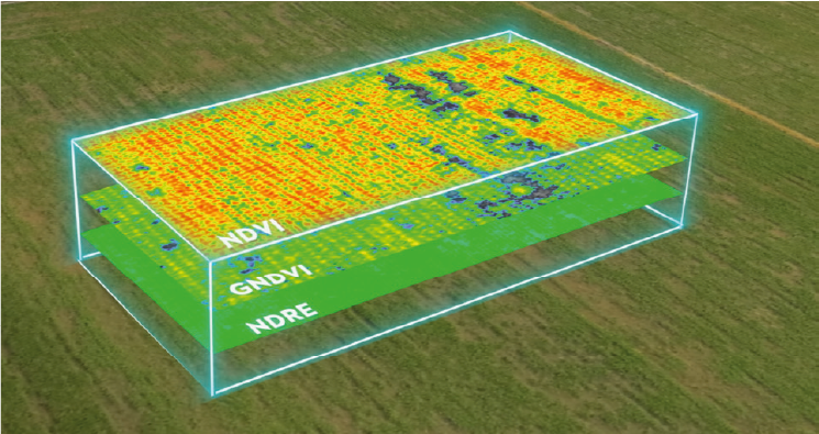
Intelligence applied in the field
Detect anomalies, evaluate plants, monitor crop development and create diagnoses, ensuring
management and awareness even in large areas.
Superior results
Get even better results and more convenience
using XFarming, Xmobots' image processing solution
. Create precise application maps,
separating spray areas from obstacles, and more.

AGILITY IN DECISION MAKING
The pilot can see in real time
how the
vegetation is developing and can identify
anomalies immediately.
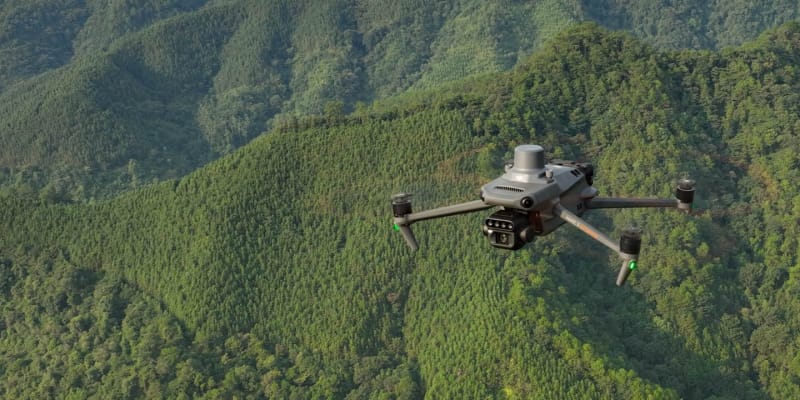
BEYOND PRECISION AGRICULTURE
The 3M Mavic can also be used for environmental and natural resource surveys, such as water enrichment monitoring, forest distribution surveys, urban green area surveys and much more.
AREA OF APPLICATION
SENSORS USED
DATA TYPES GENERATED
Forestry and Management Forestry
Multispectral, RGB, Light sensor
Biomass maps, disease detection, vegetation cover and volume estimation
Environmental Management and Conservation
Multispectral, RGB
Maps of degraded areas, land use change and analysis vegetation cover
Mining and Rehabilitation Environmental
Multispectral, RGB
Revegetation monitoring, vegetation index and before/after comparison
Planning Urban Planning/Smart Cities
RGB, Multispectral
Maps of urban coverage and heat island analysis
Water Resources/Hydrology
Multispectral, RGB
Mapping wetlands, river banks and impacts of vegetation on bodies of water
Research Scientific/University
Multispectral, RGB, Light sensor
NDVI time series, spectral vegetation analysis spectral analysis of vegetation and data
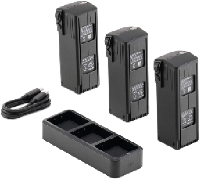
Items that improve day-to-day performance
With the 3-battery kit and charging base, daily performance increases by 2.5x.
DJI MAVIC 3M
Multispectral